Home > Europe > United Kingdom > Wales > Pembrokeshire > Milford Haven
Leeds LS25 5 Map

![]()
Wall Art and Photo Gifts from Map Marketing
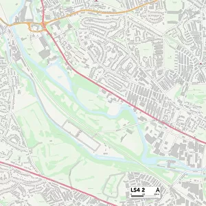
Leeds LS25 5 Map
Postcode Sector Map of Leeds LS25 5
Media ID 19973793
Beech Close Beech Drive Beech Grove Burley Close Butts Lane Chapel Street Church Lane Church View Claypit Lane Common Lane Cow Lane Croft Close Fairfield Fairfield Lane Field View Fox Lane Great North Road Green Lane Grove Crescent Harvester Way High Street Highfield Lane Hillcrest Hillside Close Leeds Low Street Lowfield Road Main Street Manor Garth Maple Close Meadow Lane Milford Road Mill Close Mill Lane Mulberry Court New Lane New Road Newfield Lane Northfield Lane Nursery Close Old Vicarage Lane Orchard Close Orchard Drive Park Lane Prospect Close Red Hill Lane Ridge Road Roe Lane Sand Lane School Lane Southlands Close Stocking Lane Swan Road The Avenue The Crescent The Haven The Limes The Meadows The Nook The Paddock Tom Lane Wain Close Water Lane Well Lane Westfield Close Westfield Court Westfield Lane Woodlands Close Woodlands Lane Lumby
FEATURES IN THESE COLLECTIONS
> Animals
> Birds
> Passerines
> Finches
> Brambling
> Animals
> Farm
> Cattle
> Related Images
> Animals
> Fishes
> R
> Red Salmon
> Animals
> Fishes
> S
> Salmon
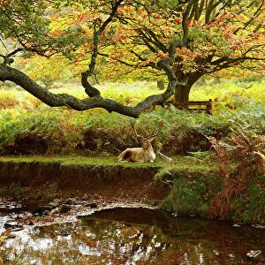
> Animals
> Mammals
> Cervidae
> Red Deer
> Animals
> Mammals
> Cervidae
> Water Deer
> Animals
> Mammals
> Dogs (Wild)
> Red Fox
> Europe
> United Kingdom
> Wales
> Pembrokeshire
> Milford Haven
> Map Marketing
> Postcode Sector Maps
> LS - Leeds
> Maps and Charts
> Related Images
MADE IN THE USA
Safe Shipping with 30 Day Money Back Guarantee
FREE PERSONALISATION*
We are proud to offer a range of customisation features including Personalised Captions, Color Filters and Picture Zoom Tools
SECURE PAYMENTS
We happily accept a wide range of payment options so you can pay for the things you need in the way that is most convenient for you
* Options may vary by product and licensing agreement. Zoomed Pictures can be adjusted in the Cart.