Home > Arts > Street art graffiti > Digital art > Vector illustrations
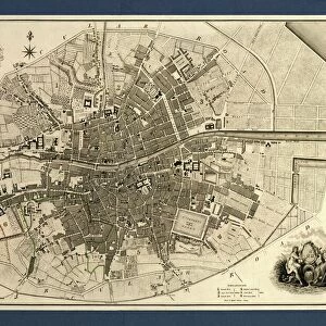
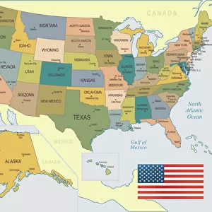
Lewisville Texas US City Street Map

![]()
Wall Art and Photo Gifts from Fine Art Storehouse
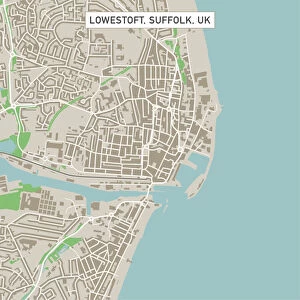
Lewisville Texas US City Street Map
Vector Illustration of a City Street Map of Lewisville, Texas, USA. Scale 1:60, 000.
All source data is in the public domain.
U.S. Geological Survey, US Topo
Used Layers:
USGS The National Map: National Hydrography Dataset (NHD)
USGS The National Map: National Transportation Dataset (NTD)
Unleash your creativity and transform your space into a visual masterpiece!
Frank Ramspott
Media ID 15192918
© Frank Ramspott, all rights reserved
Aerial View City Map Computer Graphic Directly Above Downtown District Gray Road Map Texas Text Digitally Generated Image Green Color White Color
FEATURES IN THESE COLLECTIONS
> Aerial Photography
> Related Images
> Animals
> Insects
> Hemiptera
> Green Scale
> Arts
> Contemporary art
> Digital artwork
> Street art
> Arts
> Landscape paintings
> Waterfall and river artworks
> River artworks
> Arts
> Portraits
> Pop art gallery
> Street art portraits
> Arts
> Street art graffiti
> Digital art
> Digital paintings
> Arts
> Street art graffiti
> Digital art
> Vector illustrations
> Fine Art Storehouse
> Map
> Street Maps
> Fine Art Storehouse
> Map
> USA Maps
> Maps and Charts
> Geological Map
> Maps and Charts
> Related Images
> North America
> United States of America
> Lakes
> Related Images
EDITORS COMMENTS
This stunning print captures the essence of Lewisville, Texas, USA in a detailed city street map. Created with precision and artistry, this vector illustration showcases the downtown district, lake, river, and various streets that make up this vibrant city. With a scale of 1:60,000, every intricate detail is brought to life. The source data used for this masterpiece is in the public domain and comes from reputable sources such as the U. S. Geological Survey (USGS) The National Map: National Hydrography Dataset (NHD) and USGS The National Map: National Transportation Dataset (NTD). These layers ensure accuracy and reliability. In this digitally generated image, no people are present as it focuses solely on the beauty of Lewisville's cartography. The color palette consists of shades of gray representing roads and buildings while blue signifies water bodies like lakes and rivers. White adds contrast to highlight important landmarks while green represents parks or open spaces. Designed by Frank Ramspott exclusively for Fine Art Storehouse, this aerial view from directly above provides a unique perspective on Lewisville's physical geography. Text is incorporated sparingly to provide necessary information without overwhelming the overall composition. Whether you're a resident or simply admire well-crafted maps, this print will add sophistication to any space while celebrating the charm of Lewisville, Texas.
MADE IN THE USA
Safe Shipping with 30 Day Money Back Guarantee
FREE PERSONALISATION*
We are proud to offer a range of customisation features including Personalised Captions, Color Filters and Picture Zoom Tools
SECURE PAYMENTS
We happily accept a wide range of payment options so you can pay for the things you need in the way that is most convenient for you
* Options may vary by product and licensing agreement. Zoomed Pictures can be adjusted in the Cart.