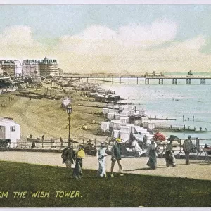
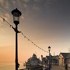
Home > Europe > United Kingdom > England > East Sussex > Eastbourne
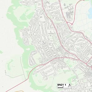
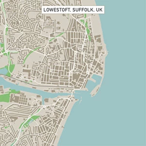
Eastbourne East Sussex UK City Street Map

![]()
Wall Art and Photo Gifts from Fine Art Storehouse
Eastbourne East Sussex UK City Street Map
Vector Illustration of a City Street Map of Eastbourne, East Sussex, UK. Included files are EPS (v10) and Hi-Res JPG.
Data courtesy from Ordnance Survey: VectorMap District
https:/ordnancesurvey.co.uk/business-and-government/products/vectormap-district.html
OS OpenData is free to use under the Open Government Licence (OGL).
Contains OS data eCrown copyright and database right 2017.
http:/nationalarchives.gov.uk/doc/open-government-licence/version/3/
Unleash your creativity and transform your space into a visual masterpiece!
Frank Ramspott
Media ID 15054913
© Frank Ramspott, all rights reserved
Aerial View Computer Graphic Directly Above East Sussex Eastbourne English Channel Gray Green Harbor North Sea Road Map Street Map Text Digitally Generated Image
FEATURES IN THESE COLLECTIONS
> Aerial Photography
> Related Images
> Arts
> Contemporary art
> Digital artwork
> Street art
> Arts
> Portraits
> Pop art gallery
> Street art portraits
> Arts
> Street art graffiti
> Digital art
> Digital paintings
> Arts
> Street art graffiti
> Digital art
> Vector illustrations
> Europe
> United Kingdom
> England
> East Sussex
> Eastbourne
> Europe
> United Kingdom
> England
> East Sussex
> Related Images
> Europe
> United Kingdom
> England
> Sussex
> Eastbourne
> Europe
> United Kingdom
> England
> Sussex
> Related Images
> Europe
> United Kingdom
> Maps
> Fine Art Storehouse
> Map
> Street Maps
EDITORS COMMENTS
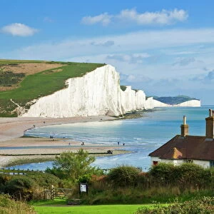
This print showcases a detailed and intricate city street map of Eastbourne, located in the picturesque region of East Sussex, UK. The vector illustration beautifully captures the essence of this charming coastal town, highlighting its harbor, coastline along the North Sea and English Channel. The map is meticulously designed with precision and accuracy using data courtesy from Ordnance Survey's VectorMap District. This reliable source ensures that every road, building, and street is accurately represented in this digitally generated image. With no people present in the picture, the focus solely lies on the impressive cartography displayed. The color image features a combination of gray, green, blue, and white tones which add depth to this aerial view captured directly above Eastbourne. Perfect for admirers of physical geography or those with an interest in computer graphics, this print offers a unique perspective on urban planning and design. It serves as both an informative tool for navigation purposes as well as an aesthetically pleasing piece of art. Frank Ramspott's expertise shines through his creation as he masterfully brings together technology and creativity to produce this visually appealing representation of Eastbourne's city streetscape.
MADE IN THE USA
Safe Shipping with 30 Day Money Back Guarantee
FREE PERSONALISATION*
We are proud to offer a range of customisation features including Personalised Captions, Color Filters and Picture Zoom Tools
SECURE PAYMENTS
We happily accept a wide range of payment options so you can pay for the things you need in the way that is most convenient for you
* Options may vary by product and licensing agreement. Zoomed Pictures can be adjusted in the Cart.