Home > Arts > Photorealistic artworks > Detailed art pieces > Masterful detailing in art
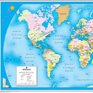
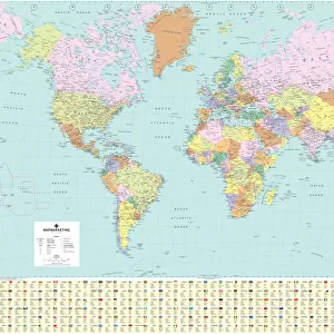
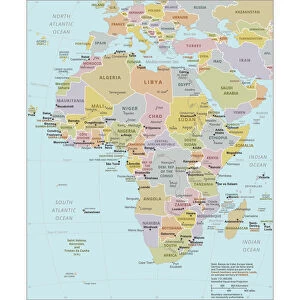
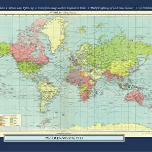
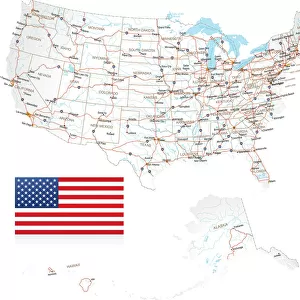
French World Political Map

![]()
Wall Art and Photo Gifts from Map Marketing
French World Political Map
A highly detailed French language World Political Map specially designed for the office or boardroom but will look equally impressive in the classroom or home. All of the labels on the map are in French. The countries are clearly defined with political colouring and main cities are clearly marked. Also features time zone clocks, international airports, primary seaports, main railways as well as international, national and state boundaries. At the base of the map is a fact panel detailing some basic socio-economic information including population and currencies for each country. Based on the Van Der Grinten projection
Media ID 19949541
© Map Marketing Ltd
FEATURES IN THESE COLLECTIONS
> Arts
> Photorealistic artworks
> Detailed art pieces
> Masterful detailing in art
> Maps and Charts
> Related Images
> Maps and Charts
> World
> Popular Themes
> Railway Posters
MADE IN THE USA
Safe Shipping with 30 Day Money Back Guarantee
FREE PERSONALISATION*
We are proud to offer a range of customisation features including Personalised Captions, Color Filters and Picture Zoom Tools
SECURE PAYMENTS
We happily accept a wide range of payment options so you can pay for the things you need in the way that is most convenient for you
* Options may vary by product and licensing agreement. Zoomed Pictures can be adjusted in the Cart.