Home > Europe > United Kingdom > England > Kent > East Malling
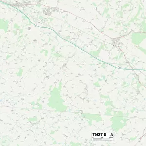
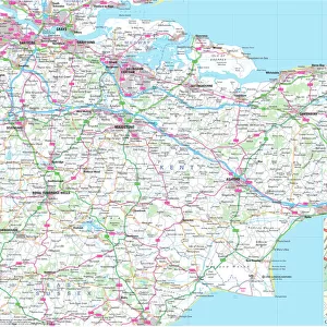
Tonbridge and Malling TN10 4 Map

![]()
Wall Art and Photo Gifts from Map Marketing
Tonbridge and Malling TN10 4 Map
Postcode Sector Map of Tonbridge and Malling TN10 4
Media ID 19980266
Allington Drive Arne Close Britten Close Cavendish Close Cherry Grove Cheviot Close Constable Road Cornwallis Avenue Coventry Road Cranford Road Croft Close Cuckoo Lane Darwin Drive Elgar Close Exeter Close Fleming Way Gilbert Close Higham Lane Howard Drive Hunt Road Landseer Close Lawrence Road Merlin Close Newton Avenue Norwich Avenue Nursery Close Orchard Drive Parkway Red House Close Rembrandt Close Reynolds Close Rochester Road Romney Way Rutherford Way Salisbury Close Salisbury Road St Pauls Close Sullivan Road The Ridgeway Thorpe Avenue Tonbridge And Malling Tonbridge Road Turner Road Vaughan Avenue Walton Road Wells Close Wilson Road Winchester Road York Road
FEATURES IN THESE COLLECTIONS
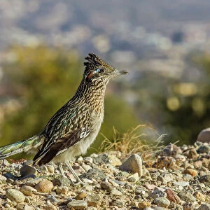
> Animals
> Birds
> Cuckoos
> Related Images
> Animals
> Birds
> Passerines
> Whistlers
> Related Images
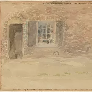
> Arts
> Artists
> R
> Rembrandt
> Arts
> Artists
> W
> Frank Weller
> Arts
> Artists
> W
> Helen Wilson
> Arts
> Artists
> W
> Wilson Wilson
> Europe
> United Kingdom
> England
> Kent
> Canterbury
> Europe
> United Kingdom
> England
> Kent
> East Malling
> Europe
> United Kingdom
> England
> Kent
> Grove
> Map Marketing
> Postcode Sector Maps
> TN - Tunbridge Wells
MADE IN THE USA
Safe Shipping with 30 Day Money Back Guarantee
FREE PERSONALISATION*
We are proud to offer a range of customisation features including Personalised Captions, Color Filters and Picture Zoom Tools
SECURE PAYMENTS
We happily accept a wide range of payment options so you can pay for the things you need in the way that is most convenient for you
* Options may vary by product and licensing agreement. Zoomed Pictures can be adjusted in the Cart.