Home > North America > United States of America > Arizona > Chandler
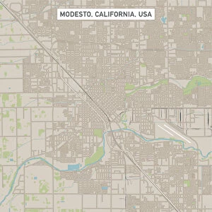
Chandler Arizona US City Street Map

![]()
Wall Art and Photo Gifts from Fine Art Storehouse
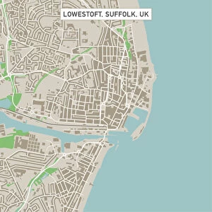
Chandler Arizona US City Street Map
Vector Illustration of a City Street Map of Chandler, Arizona, USA. Scale 1:60, 000.
All source data is in the public domain.
U.S. Geological Survey, US Topo
Used Layers:
USGS The National Map: National Hydrography Dataset (NHD)
USGS The National Map: National Transportation Dataset (NTD)
Unleash your creativity and transform your space into a visual masterpiece!
Frank Ramspott
Media ID 15055179
© Frank Ramspott, all rights reserved
Aerial View Arizona Computer Graphic Directly Above Gray Green Road Map Street Map Text Chandler Digitally Generated Image
FEATURES IN THESE COLLECTIONS
> Aerial Photography
> Related Images
> Animals
> Insects
> Hemiptera
> Green Scale
> Arts
> Contemporary art
> Digital artwork
> Street art
> Arts
> Landscape paintings
> Waterfall and river artworks
> River artworks
> Arts
> Portraits
> Pop art gallery
> Street art portraits
> Arts
> Street art graffiti
> Digital art
> Digital paintings
> Arts
> Street art graffiti
> Digital art
> Vector illustrations
> Fine Art Storehouse
> Map
> Street Maps
> Fine Art Storehouse
> Map
> USA Maps
> Maps and Charts
> Geological Map
> Maps and Charts
> Related Images
> North America
> United States of America
> Arizona
> Chandler
EDITORS COMMENTS
This print showcases a meticulously detailed city street map of Chandler, Arizona, USA. With a scale of 1:60,000, every intricate aspect of this vibrant city is beautifully illustrated in vector format. The source data used for this artwork is all from the public domain and includes USGS The National Map: National Hydrography Dataset (NHD) and USGS The National Map: National Transportation Dataset (NTD). The image captures the essence of Chandler with its meandering river, serene lake, numerous buildings, and bustling streets. It provides an excellent overview of the city's layout and cartography. Digitally generated with no people present in the scene, it offers a clear focus on the physical geography and design elements. Displayed in striking colors such as gray, green, blue, and white against a textured background adds depth to the composition. Its aerial perspective gives viewers a unique vantage point directly above Chandler's urban landscape. This visually stunning piece by Frank Ramspott is perfect for those who appreciate art that combines technology with cartographic precision. Whether you are an admirer of maps or simply want to celebrate your love for Chandler's charm and beauty, this print will surely captivate your imagination.
MADE IN THE USA
Safe Shipping with 30 Day Money Back Guarantee
FREE PERSONALISATION*
We are proud to offer a range of customisation features including Personalised Captions, Color Filters and Picture Zoom Tools
SECURE PAYMENTS
We happily accept a wide range of payment options so you can pay for the things you need in the way that is most convenient for you
* Options may vary by product and licensing agreement. Zoomed Pictures can be adjusted in the Cart.