Home > Africa > Angola > Maps
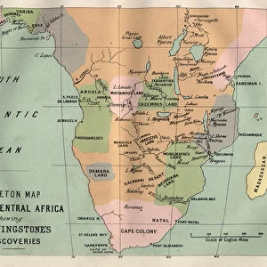
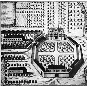
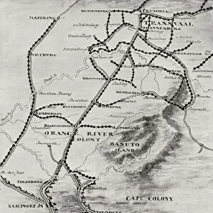
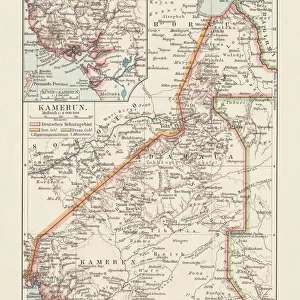
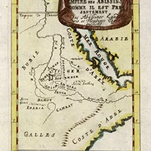
Map of Mid. And South Africa, 1919. Creator: George Philip & Son Ltd

![]()
Wall Art and Photo Gifts from Heritage Images
Map of Mid. And South Africa, 1919. Creator: George Philip & Son Ltd
Map of Mid. And South Africa, 1919. Showing European possessions at outbreak of war, [the First World, 1914]. From " The History of the Great European War: its causes and effects", Vol. VIII, by W. Stanley Macbean Knight. [Caxton Pulishing Company, Limited, London, 1919]
Heritage Images features heritage image collections
Media ID 19047691
© The Print Collector/Heritage Images
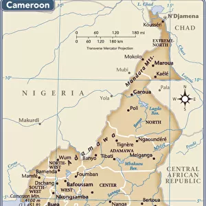
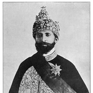
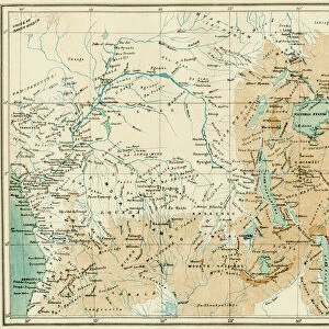
Abyssinia And Son Ltd Angola Belgian Congo Cameroon Caxton Publishing Company Caxton Pulishing Company Caxton Pulishing Company Lim Caxton Pulishing Company Limited Caxton Pulishing Company Ltd Congo Ethiopia George Philip And Son George Philip And Son Ltd German Empire Imperial Imperialism Knight Limited Namibia Philip Portugal Portuguese Rhodesia South Africa Stanley Macbean Stanley Macbean Knight Sudan W Stanley Macbean W Stanley Macbean Knight William Stanley Macbean William Stanley Macbean Knight British Empire Cameroons German South West Africa
FEATURES IN THESE COLLECTIONS
> Africa
> Angola
> Related Images
> Africa
> Cameroon
> Related Images
> Africa
> Ethiopia (Abyssinia)
> Maps
> Africa
> Ethiopia (Abyssinia)
> Related Images
> Africa
> Ethiopia
> Related Images
> Africa
> Namibia
> Related Images
> Africa
> South Africa
> Maps
EDITORS COMMENTS
This print showcases a detailed "Map of Mid. And South Africa, 1919" created by George Philip & Son Ltd. The map provides a fascinating glimpse into the European possessions in Africa at the outbreak of World War I in 1914. It was featured in Volume VIII of "The History of the Great European War: its causes and effects" by W. Stanley Macbean Knight, published by Caxton Publishing Company Limited in London. The map is richly colored, highlighting various countries and empires that held territories within Africa during this period. From British Empire colonies such as South Africa and Rhodesia to French Equatorial Africa and Portuguese holdings like Angola, it offers an insight into the vast imperial presence on the continent. Notably, German Empire's control over German South West Africa (present-day Namibia) can be observed alongside Abyssinia (Ethiopia), Sudan, Cameroon, Belgian Congo, and Italian territories. This visual representation underscores the extent of colonialism and imperialism prevalent during that era. With its historical significance and intricate details, this print serves as a valuable resource for researchers studying African history or anyone interested in exploring how political boundaries have evolved over time on the continent. Its preservation through Heritage Images ensures that future generations can appreciate this remarkable piece of cartographic artistry from early 20th-century Europe without commercial use implications mentioned explicitly by requesters.
MADE IN THE USA
Safe Shipping with 30 Day Money Back Guarantee
FREE PERSONALISATION*
We are proud to offer a range of customisation features including Personalised Captions, Color Filters and Picture Zoom Tools
SECURE PAYMENTS
We happily accept a wide range of payment options so you can pay for the things you need in the way that is most convenient for you
* Options may vary by product and licensing agreement. Zoomed Pictures can be adjusted in the Cart.