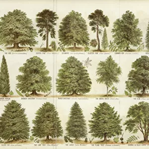
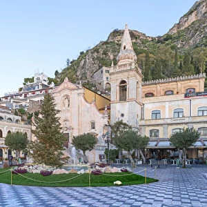
Home > Europe > Italy > Sicily > Messina
Portolan of Joan Martines (16th century). 1587. Map of the C
. 1587. Map of the C")
![]()
Wall Art and Photo Gifts from Mary Evans Picture Library
Portolan of Joan Martines (16th century). 1587. Map of the C
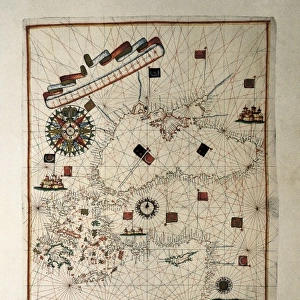
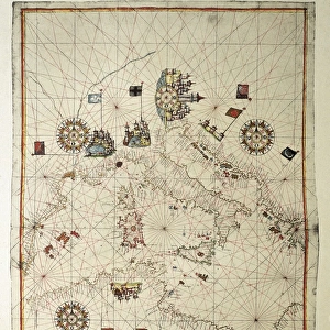
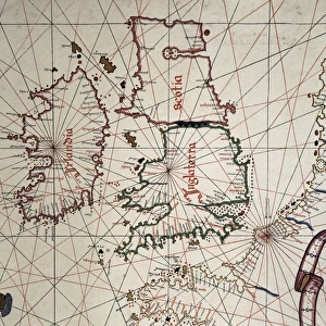
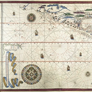
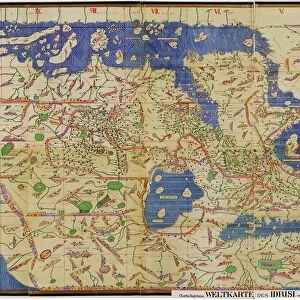
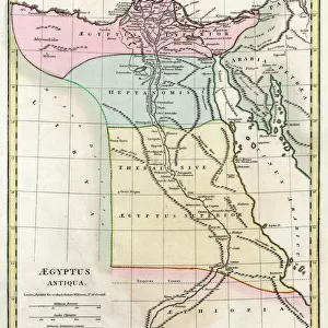
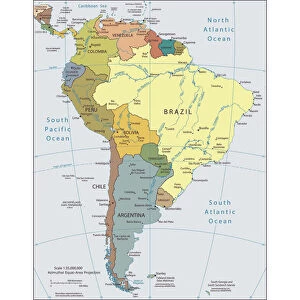
Portolan of Spanish cartographer Joan Martines (16th century). Majorcal school. 1587. Map of the Canary Islands and the west coast of Africa. Messina, Sicily. National Library. Madrid. Spain
Mary Evans Picture Library makes available wonderful images created for people to enjoy over the centuries
Media ID 14353944
© Thaliastock / Mary Evans
1587 Atlas Canary Cartographer Cartography Coastline Discovery Geography Joan Martines Messina Portolan Sicily
FEATURES IN THESE COLLECTIONS
> Africa
> Related Images
> Arts
> Artists
> S
> Spanish School
> Europe
> Italy
> Sicily
> Messina
> Europe
> Italy
> Sicily
> Related Images
> Europe
> Spain
> Related Images
EDITORS COMMENTS
This stunning 16th-century map, titled "Mapa de Africa Occidental" or "Map of Western Africa," is a masterpiece by Joan Martines, a Spanish cartographer from the Majorcan school. Created in 1587, this Portolan chart depicts the Canary Islands and the western coast of Africa in remarkable detail. The map was produced during a time of significant exploration and discovery, as European powers were expanding their reach beyond Europe and into the New World. The map is held in the National Library of Spain in Madrid, and is a testament to the advanced cartographic skills of the Majorcan school. The intricate detail of the coastline and the placement of islands and landmasses demonstrate the level of knowledge and expertise that existed during this period. The map also includes several annotated labels, indicating the locations of important ports and cities, such as "Messina," "Tunis," and "Casablanca." The map's vibrant colors and ornate decorative elements add to its visual appeal, making it a valuable addition to any collection of historical maps or atlas. The age of discovery saw the world being explored and charted like never before, and maps like this one played a crucial role in documenting and understanding the new territories. The intricate detail and accuracy of this map are a testament to the skill and dedication of Joan Martines and the Majorcan school of cartography.
MADE IN THE USA
Safe Shipping with 30 Day Money Back Guarantee
FREE PERSONALISATION*
We are proud to offer a range of customisation features including Personalised Captions, Color Filters and Picture Zoom Tools
SECURE PAYMENTS
We happily accept a wide range of payment options so you can pay for the things you need in the way that is most convenient for you
* Options may vary by product and licensing agreement. Zoomed Pictures can be adjusted in the Cart.