Home > Architecture > Towers > Castles
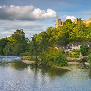
Shropshire SY8 1 Map

![]()
Wall Art and Photo Gifts from Map Marketing
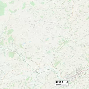
Shropshire SY8 1 Map
Postcode Sector Map of Shropshire SY8 1
Media ID 19982586
Ash Close Baker Close Ballard Close Bell Lane Belle Vue Terrace Broad Street Bromley Road Bull Ring Camp Lane Castle Square Castle Street Chandlers Close Chestnut Grove Church Street Churchill Close College Street Coronation Avenue Felton Close Gravel Hill Green Acres Henley Road High Street Hillside Housman Close James Close Julian Road Kershaw Close King Street Langford Close Market Street Mill Street Milton Road Morgan Close Old Street Overton Road Park Road Pepper Lane Potter Close Priory Gardens Rock Lane Sandford Road Shropshire Sidney Road Springfield Close St Johns Lane St Johns Road St Marys Lane St Marys Mews St Stephens Close Station Drive The Paddocks Tollgate Road Tower Street Townsend Close Wheeler Close Dinham Harp Lane Ludford Ludlow
FEATURES IN THESE COLLECTIONS
> Architecture
> Towers
> Castles
> Architecture
> Towers
> Churches
> Arts
> Artists
> B
> John Bromley
> Arts
> Artists
> C
> John Charlton
> Arts
> Artists
> F
> John Field
> Arts
> Artists
> H
> John Hillers
> Arts
> Artists
> H
> John Hills
> Arts
> Artists
> M
> John Milton
> Arts
> Artists
> M
> John Morgan
> Arts
> Artists
> O
> Elizabeth Olds
> Map Marketing
> Postcode Sector Maps
> SY - Shrewsbury
MADE IN THE USA
Safe Shipping with 30 Day Money Back Guarantee
FREE PERSONALISATION*
We are proud to offer a range of customisation features including Personalised Captions, Color Filters and Picture Zoom Tools
SECURE PAYMENTS
We happily accept a wide range of payment options so you can pay for the things you need in the way that is most convenient for you
* Options may vary by product and licensing agreement. Zoomed Pictures can be adjusted in the Cart.