Home > Arts > Artists > F > John Field
Cherwell OX5 3 Map

![]()
Wall Art and Photo Gifts from Map Marketing
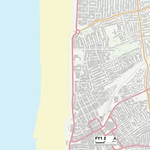
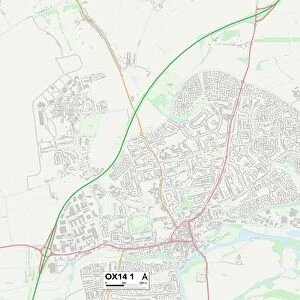
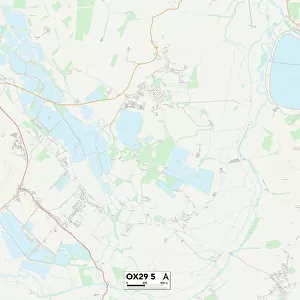
Cherwell OX5 3 Map
Postcode Sector Map of Cherwell OX5 3
Media ID 19977184
Ball Lane Balliol Close Banbury Road Bunkers Hill Canal Close Canal Way Causeway Cherwell Church End Church Hill Church Lane Fox Hill Heyford Road Lime Kiln Road Mill Lane New Road North Green Oxford Close Oxford Road Park Close Pound Close Roman Close Sands Close South Green Springwell Close St Johns Road St Nicholas Road Station Road The Chestnuts The Green The Ridge Weston Road Woodbank Coghill St Giles
FEATURES IN THESE COLLECTIONS
> Arts
> Artists
> F
> John Field
> Arts
> Artists
> H
> John Hillers
> Arts
> Artists
> H
> John Hills
> Arts
> Artists
> R
> Roman Roman
> Map Marketing
> Postcode Sector Maps
> OX - Oxford
> Maps and Charts
> Related Images
MADE IN THE USA
Safe Shipping with 30 Day Money Back Guarantee
FREE PERSONALISATION*
We are proud to offer a range of customisation features including Personalised Captions, Color Filters and Picture Zoom Tools
SECURE PAYMENTS
We happily accept a wide range of payment options so you can pay for the things you need in the way that is most convenient for you
* Options may vary by product and licensing agreement. Zoomed Pictures can be adjusted in the Cart.